In our increasingly complicated world full of global issues and tensions, IB Geography has never been as important for Pao School students as it is today. IB Geography gives our students an opportunity to dive deeper into the news headlines and truly understand them as well as help them develop a global perspective. In helping to bridge the divide between the classroom and the real world, IB Geography fieldwork helps to reinforce students’ understanding of geographical terminology and processes and gets them ready for university-level learning.
——Peter Davison
High School Humanities Teacher
Recently, 36 students from the Year 12 IB Geography class visited the lush bamboo forests of Moganshan to collect their own data for an important assignment on river characteristics. The students spent time onsite to complete their investigation – some of which required the use of GPS and drones to capture information. The trip provided an interesting insight into the data collection process for the students while allowing them to gain a geographical understanding of the environment in their own backyard.
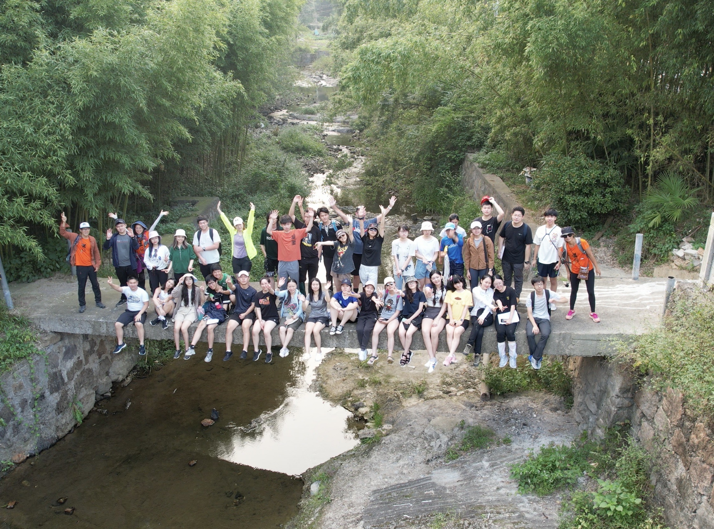
Geography is a complex topic, approaching the world from both a scientific and social science perspective. As it is concerned with the physical properties of a location, geographers frequently conduct scientific investigations, but this information is then drawn out to explore the location and its relationship with human society and the wider environment. This information can then contribute to considerations of possible management strategies associated with such change for the future. As geography is so far-reaching, IB Geography students must learn about a wide breadth of topics, including areas such as global resource consumption, geophysical hazards, the geography of food and health, human development, and oceans and coasts.
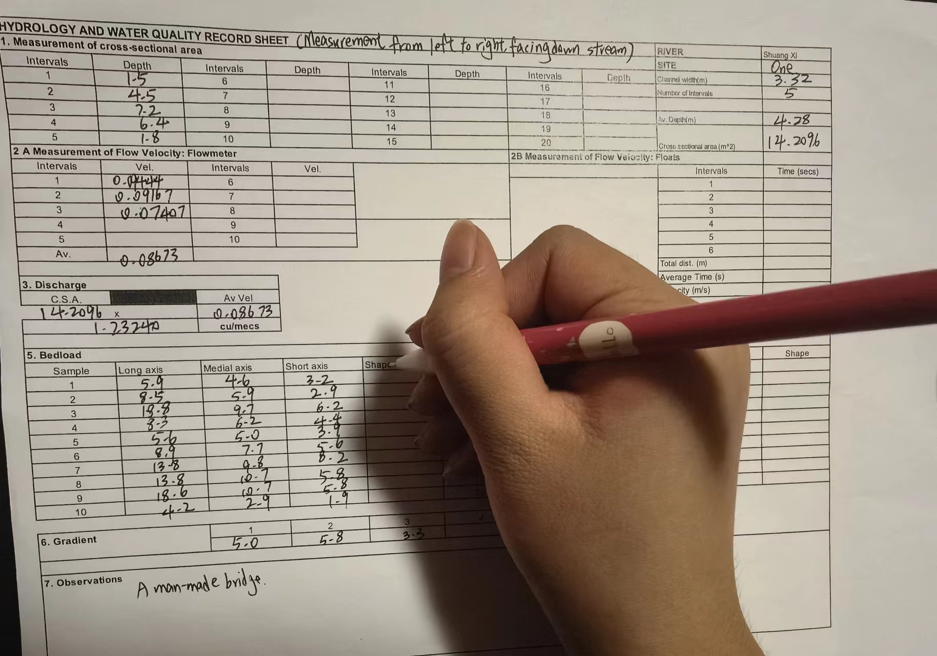
Each year, the IB Geography team has traditionally gone on a fieldwork trip, which allows the students to get field experience and gather the data that they need to produce a report for their IB Internal Assessment (IA). As the students’ other assessments are exam based, the IA is also a chance for students to show off their practical skills and gain an experiential understanding of the discipline. For this, students need to gather their own data and produce a fieldwork report on their research – much like a shorter version of a university thesis or academic paper. Though they can collect data onsite in groups, each student produces their own 2,500-word fieldwork reports by themselves. Within the report, students must include a hypothesis, methods for the investigation, their data, and a written analysis. The students also need to complete an evaluation of the project, providing an important opportunity for students to think like scientists and consider how to conduct more accurate investigations in the future.
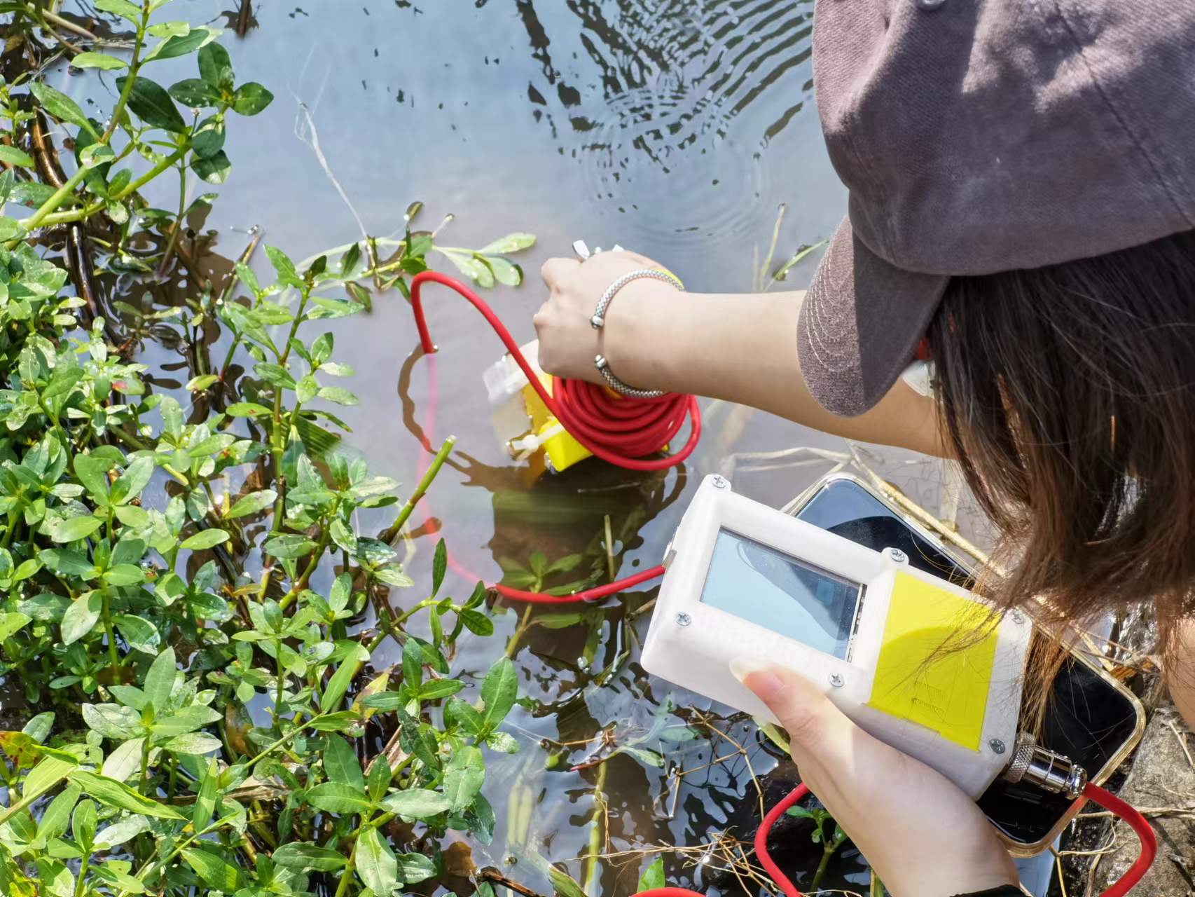
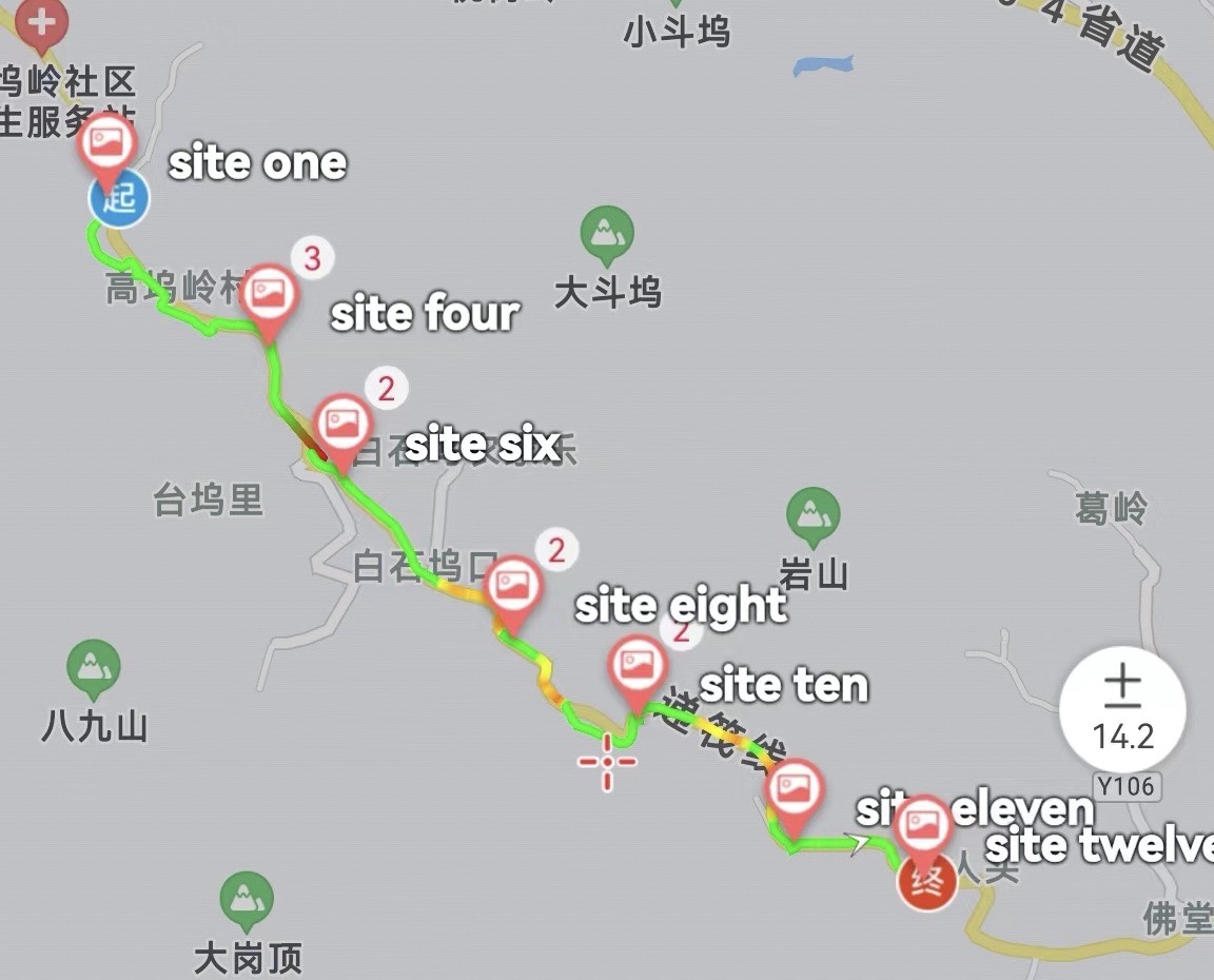
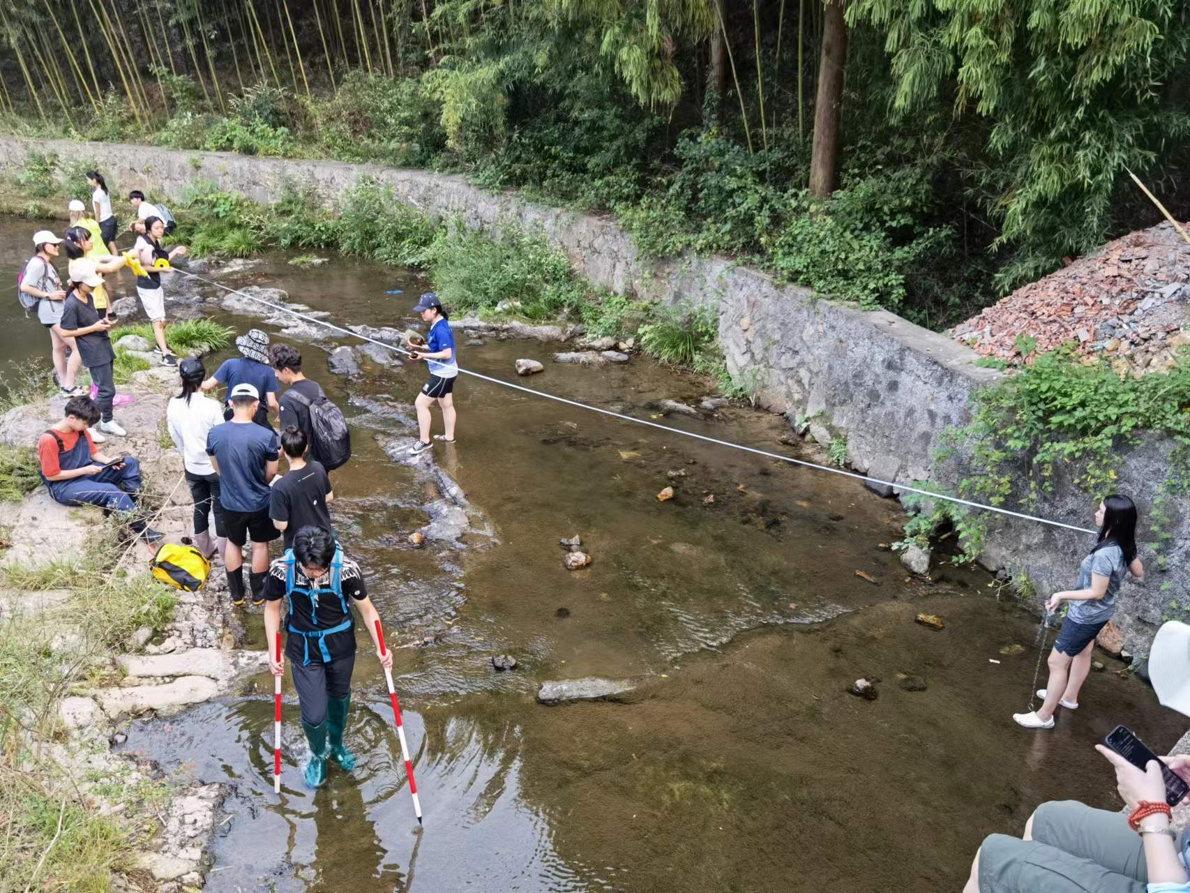
This year, the students were lucky to conduct their research in Houwu, a small village in Moganshan. As they were focusing on the characteristics of rivers and processes related to river flow, their focus was on the Duihe. In order to collect the data systematically, the students visited 13 fixed sites along the length of the river to conduct various tests, such as calculating how much water flows through the river, measuring the river’s bedload and gradient, and collecting different observations about the river valley.
Out of the Classroom, into Nature
Petunia (Y12) explains that the trip was an opportunity to apply what she has learned in the classroom to the real world. As “what is on paper doesn’t always reflect the real world”, the trip gave the students vital fieldwork experience. In particular, alongside their technical knowledge, the field requires students to utilise other skills such as collaboration and communication as a group – as they were collecting a complex set of data that required working together to complete multiple tasks at the same time. Alongside collecting the data, the students also needed to take photos, note the conditions around the area, use their maps, and work with a drone to take images from above.
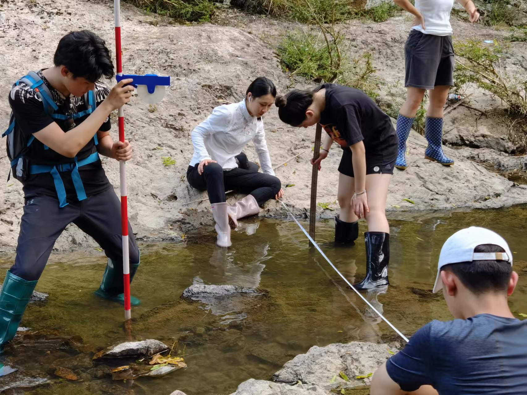
The students also needed to develop their ability to be flexible in response to real-world conditions. As it was the first time Petunia had been on a geography trip of this kind, it was her also first experience with conducting experiments outside of controlled conditions in a classroom. For example, at one point her group needed to adapt their method for measuring the river flow as the water was too shallow and they could not use a flowmeter to take measurements.

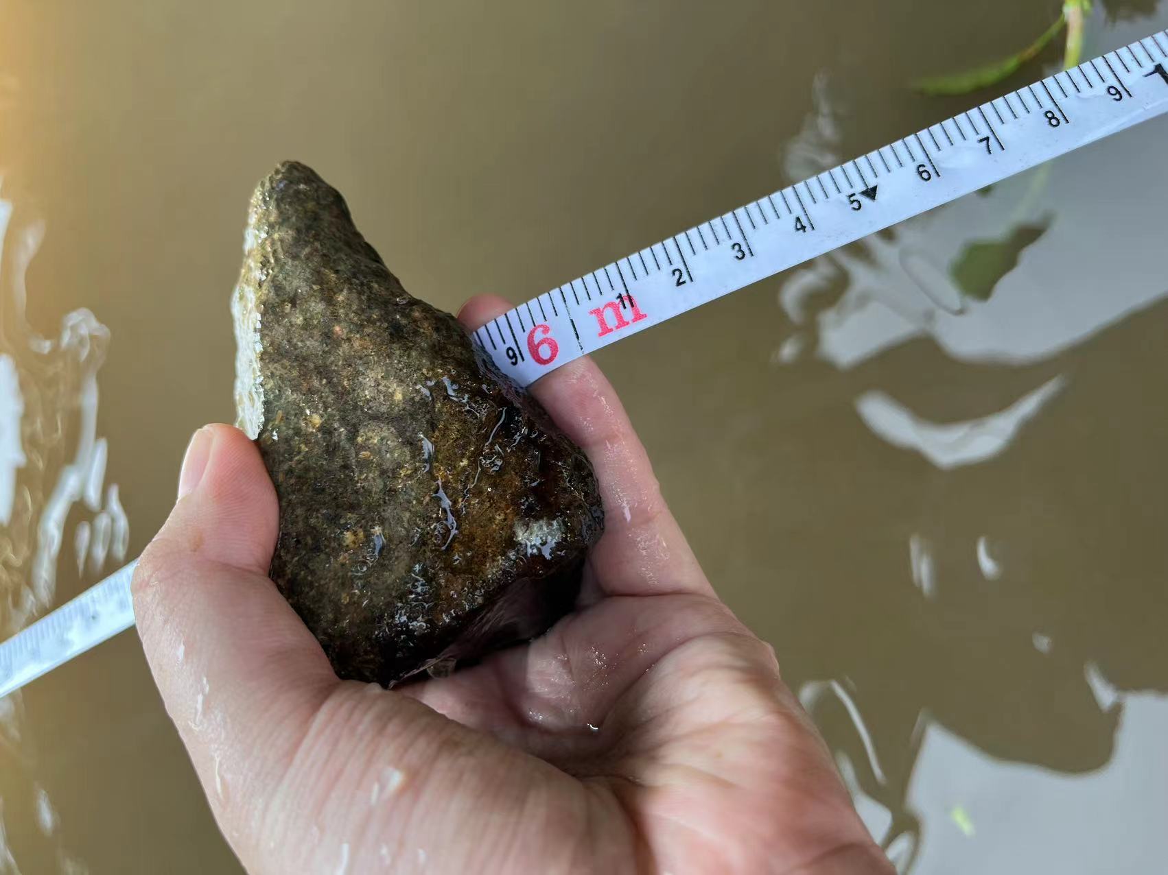
Another challenge was the data itself, both during collection and during analysis. As they were sampling rocks from the river and assessing their “roundness” using a scale, the students needed to make sure to evaluate the rocks consistently. However, each student had a different understanding of how to categorise the rocks on the scale. In the end, the group talked through the problem and came up with the solution to take photos of their sample rocks to review later on.
“It doesn't mean your data is wrong, I think it's about just recording authentically and being able to just accept the circumstances,” says Petunia, who had found the data her group collected wasn’t as expected compared to what you see in the textbooks. It was a mindset shift for Petunia, as she had to learn to analyse the unexpected and accept that the real world doesn’t always produce perfect data.
In addition to applying their technical skills, the trip was also a chance for the students to learn more about the culture of Moganshan and its relationship to geography. For Petunia, one of her favourite aspects of the trip was being taught by the teachers about how bamboo growth influenced the people in the area through things like boat building and basket weaving.
Measuring Moganshan
During the trip, the students conducted a variety of experiments to measure different the characteristics of Moganshan’s rivers. But what exactly did they do?
1. Calculating how much water flows through the river
In order to apply the equation to calculate the river flow, the students needed to find the cross-sectional area of the river (river width x depth) and the river’s flow velocity.
Cross-sectional Area
Find the below values for the equation (river width x depth) to calculate the cross-sectional area.
Width: Use a measuring tape to measure across the surface of the river, from bank to bank.
Depth: Place ten poles at equidistant intervals across the width of the river and then collect 10 measurements of the depth. After that, the measurements can be averaged to accurately find the value.
Flow Velocity
2. Measuring river bedload (pebble size and shape)
The students took 20 bedload samples at each site, and then measured the sample sizes and “scale of roundness”.
3. Measuring the river gradient
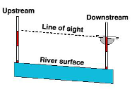
The students used ranging poles and a clinometer to measure the river gradient.
4. Collecting different observations about the river valley
At each location, the students needed to take photos of the following: the river channel characteristics, the surrounding landscape and land uses, factors that may affect the river channel (such as human interferences like dams), and photographs of the data collection to include in their final report method section.
An Interconnected World
In the future, Will is interested in majoring in sociology – which was a major factor in his choice to pursue IB Geography. This is because the subject is connected to many different fields, Will explains, “Geography is the closest related subject to sociology, and contains not only geophysical but political, economic, and sociological perspectives. The subject has the most content, yet the content is interrelated, allowing me to observe the world from a higher level.” By studying IB Geography, Will has significantly improved his ability to analyse graphical information, deduce trends, and point out anomalies.
Petunia saying that her studies have taught her to see different perspectives and arguments when discussing social and political issues. For example, when talking about globalisation and global conglomerates, students learn to consider aspects such as the benefits, such as access to a variety of food from around the world, and downsides, such as harm caused to the environment.
She says, “Geography IB covers much more content, in much more depth than IGCSE. When a question is asked, rather than just giving different arguments and facts, you also learn to evaluate the facts based on the argument's perspective, its scale, and its power.”
In this way, students also learn how to apply their academic knowledge to current events and the real-world context. Petunia says that their teacher, Mr. Davison, sometimes asks the students to look at the news and analyse events through the eye of a geographer – for example, the connection of the war in Ukraine to the energy crisis in Europe.